August 9
Today we drove out to the northwest corner of the island (we are staying in the northeast corner). The NW is very wild and windblown. We stopped first at Le Moulin de Lecq, one of several ancient watermills that traces back 600 years, and was used to grind corn until 1929. Apparently it was running until a couple of years ago, but is now dry.
 |
| Le Moulin de Lecq |

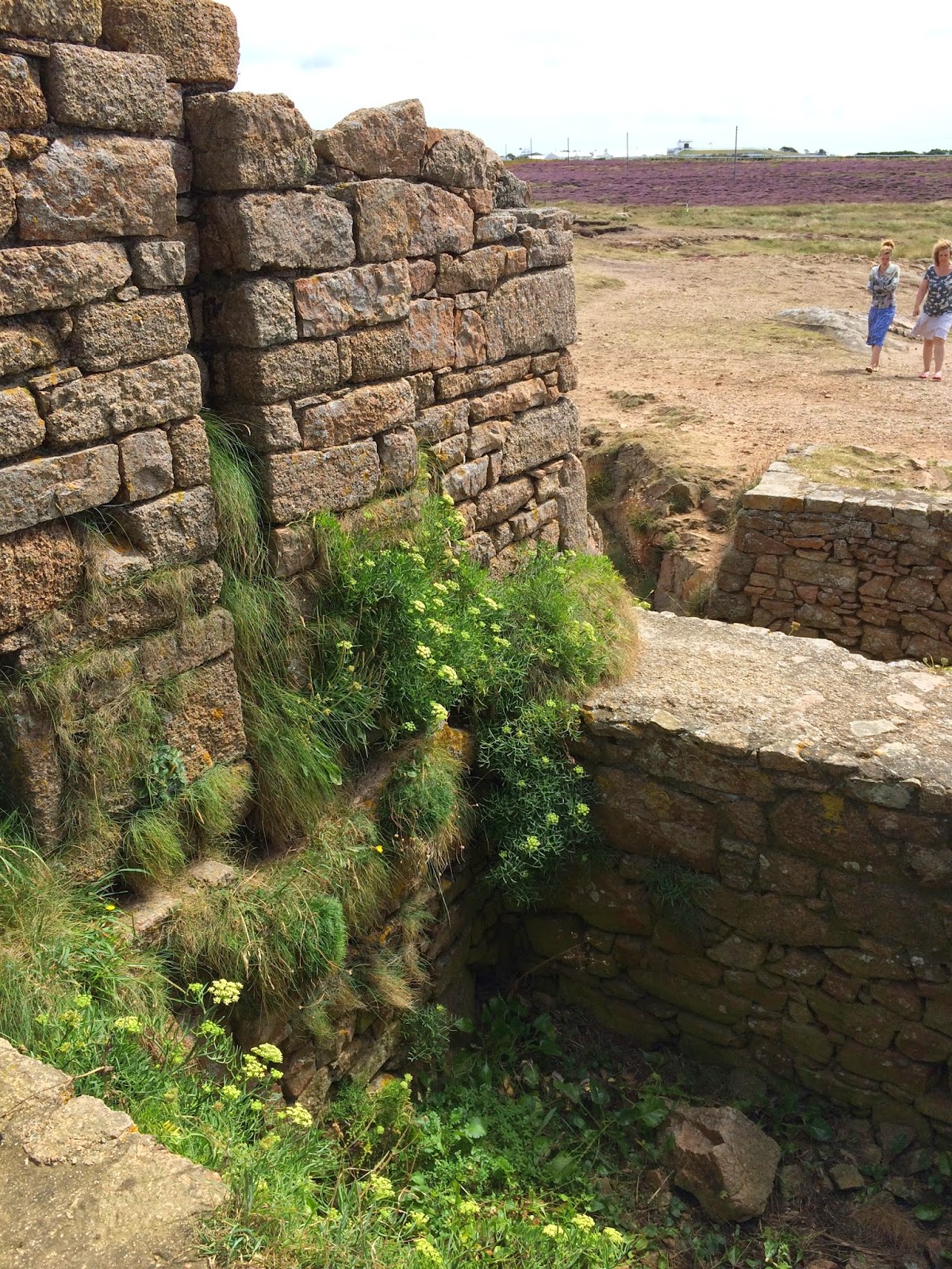
From there we carried on to Grosnez Castle - if I translate that into French, I think it means large nose! However, it is thought that it goes back to old Norse words ‘grar nes’, meaning the Grey Headland. I’m not so sure of that either, as the rock is all a beautiful reddish colour. However, apparently from the sea, it looks grey, so perhaps that’s true.
 |
| The remains of Grosnez Castle |
 |
| A view from the doorway - a big rocky moor without too many trees |
 |
| Groove in the wall that would house a sliding-down door or gate |
It’s estimated the castle was built in1330, but the location was a very poor choice, as the water supply was across the headland on a different point of land. That left the inhabitants rather vulnerable and it was taken several times over the years. Not much left of it now - all the rock from buildings tends to get “recycled” into new homes over the years and that happened before people got smart and started protecting these sites.
 |
| View across the chasm from the castle to the "water supply". Someone wasn't thinking too hard when they did the building plan. |
 |
| View from the castle looking back towards England |
 |
| Lighthouse - crazy rocky shore |
 |
| Shoreline near Grosnez - not too easy to hike around down there! |
 |
| You can also see France from here! |
We carried on to the 5-mile road, which according to Sarge is only 3 miles. Unfortunately we couldn’t test his assertion, since the road was closed about a mile along. We were able to get some pictures of the fantastic beach here, which is dotted with German bunkers, and walled along its entire length - a fortification again built by the Germans. It’s still in great shape - they knew how to build things right!
 |
| View of the 5-mile road beach and some hang gliders. Wish I had the nerve to do that! |
 |
| Now that's a beach! |
 |
| Miles of beach, and a big German wall built all the way along it. |
 |
| The wall on the beach - probably about a 10' drop. |
 |
| German bunker on the beach. One of many. |
 |
| I'm pretty sure this is Kempt Tower on the 5-mile road beach. |
 |
| From atop the tower. They had a pretty good view of anything coming into shore here during the war. |
When we arrived home, I had a little visit with Edwina and we chatted about the history of her house. It’s thought it was originally a barn belonging to a large house up the hill that was sold off a few years ago. They think it was built about 400 years ago, and one of the interesting things is these little rock protrusions on the wall - these are “fairy rocks” for fairies and witches to have a place to land and rest. If these were not provided, it was believed a curse might be placed on the building by said fairies and witches.
 |
| Harvey welcoming us home! |
 |
| Colin needed a pat too! |
 |
| The Fairy Rocks protruding from the house. |
During some gardening excavation several years ago, they dug up a lot of old granite blocks as well as this old cider wheel! - this would stand in a circular ‘tub’ and a horse would drag it around the tub while women threw apples into it. The wheel would crush the apples and juice would flow out little drains. The remaining pulp was turned into a product called “Black Butter”. I haven’t had a chance to try it while I’ve been here - maybe I can find some at the market before we leave. Here’s an interesting link if you want to know more about this. Cider wheel: http://bit.ly/VPLix6 and Black Butter: http://bbc.in/1qqF2rL
 |
| The Cider wheel - very cool little table now! |
We ended the day with a hike in the opposite direction from Rozel Bay and went along St. Catherine’s Bay, Anne Port (nice name!) and down to Gorey Castle at the Royal Bay of Grouville. Actually, the castle name is Mont Orgueil, but it’s fondly known as Gorey by the locals. It’s a 600 year old castle built on a huge outcrop of rock, and sits above the bay looking very important. We didn’t go inside - we’ve seen enough castles for now, but it’s always fun to walk the grounds and take pictures.
 |
| Archirondel Tower at Archirondel Beach with St. Catherine's breakwater in the background. This has been converted to a hotel if you want an unusual vacation experience: http://bit.ly/XQ0v3a |
 |
| Anne Port Beach and village. Nice name :-) |
 |
| Anne Port home - love the driveway arch! And yes, it empties right onto the road. The house wall is the road edge. |
 |
| Loved this old former inn at Anne Port. A few hundred years old. The new owners have apparently submitted a plan to have the entire front of the house done with a glass wall. Nice location for storm watching! |
 |
| An old water pump seen on our walk |
From there, we walked down to the colourful little town of Grouville Bay and did a little window shopping. We walked along the pier, and noticed literally hundreds of dead crabs floating in the water. Turns out they weren’t dead crabs, just the shedded (is that a word?) shells of spider crabs. Never heard of that before! Sarge came along later and we had a pint at the pub before heading home for dinner.
 |
| Mont Orgueil Castle aka Gorey Castle from the road. |
 |
| Grouville Bay. All those boats will be sitting on the sand bottom in a few hours. |
 |
| The colourful village of Grouville Bay |
 |
| Who wouldn't like to have a castle sitting above their village? |
 |
| Random pub shot - for a moment I was sure my friend Carol had just walked in! Not her though. |
No comments:
Post a Comment